


train de la Mure

bianchireg
User
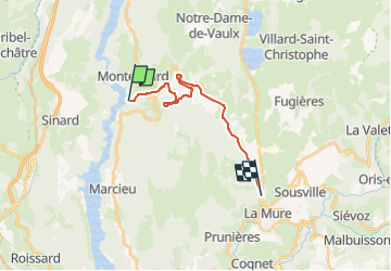

Length
15.4 km

Max alt
968 m

Uphill gradient
402 m
Km-Effort
20 km

Min alt
663 m

Downhill gradient
193 m
Boucle
No
Creation date :
2023-04-02 12:45:31.741
Updated on :
2023-04-02 12:45:32.565
4h33
Difficulty : Medium

FREE GPS app for hiking
 SityTrail
IGN / Geographical institutes
SityTrail Plus
The world is yours!
About
Trail Walking of 15.4 km to be discovered at Auvergne-Rhône-Alpes, Isère, La Motte-Saint-Martin. This trail is proposed by bianchireg.
Description
parcours en service
Positioning
Country:
France
Region :
Auvergne-Rhône-Alpes
Department/Province :
Isère
Municipality :
La Motte-Saint-Martin
Location:
Unknown
Start:(Dec)
Start:(UTM)
712915 ; 4981413 (31T) N.
Comments